- You have not saved any projects.
Magnolia
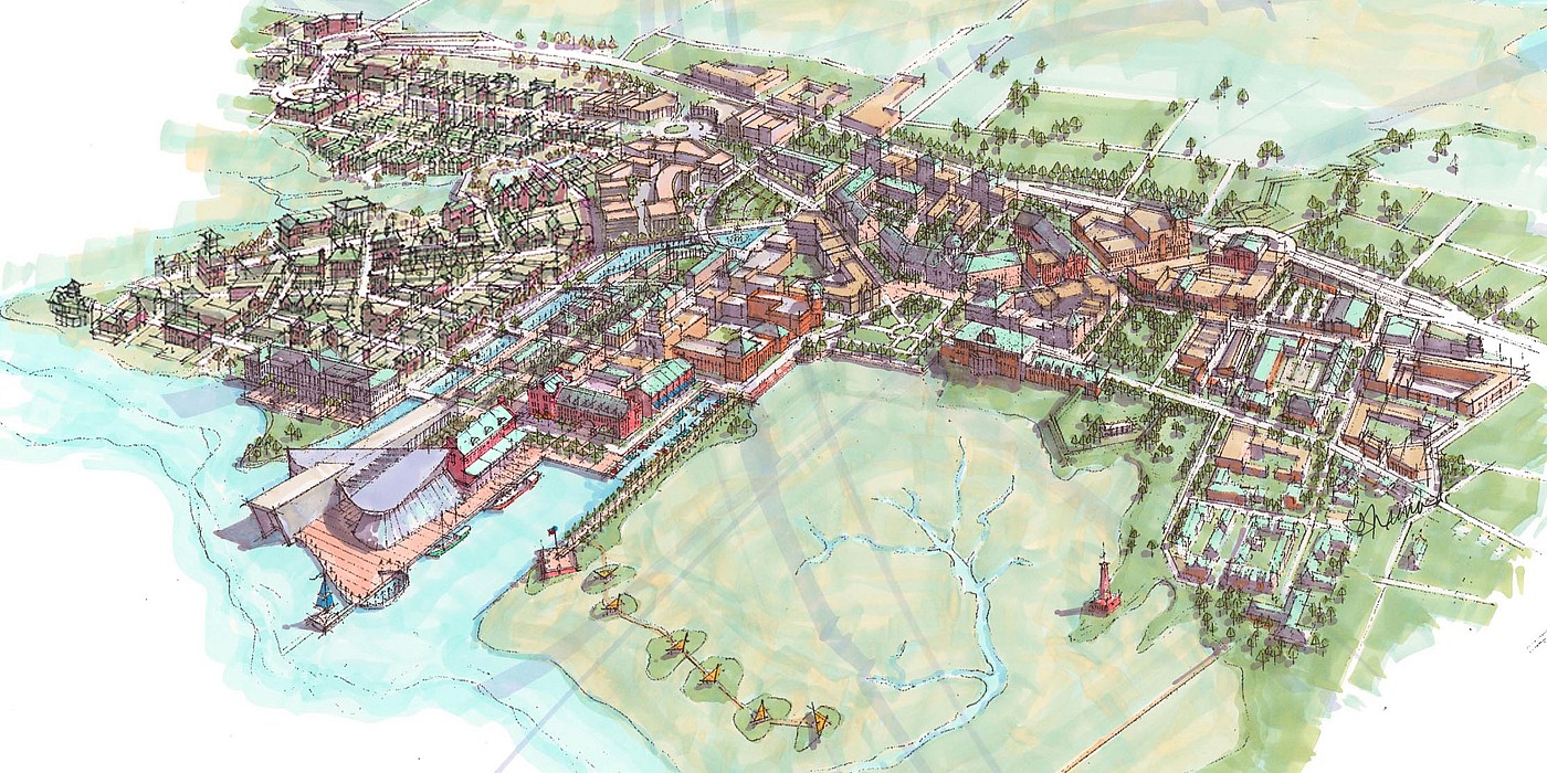
For Greenhawk Partners, LLC and the Cherokee Fund, Shook Kelley developed a concept vision and master plan to reclaim and redevelop an environmentally challenged land tract between the Ashley and Cooper rivers. Magnolia is an endeavor that embraces the existing communities, restores the environmental and historic resources of the area, and engages every level of the public process to serve as a "sprawl buster" for the entire region. Via a public process, a vision was crafted that will embrace existing communities and restore environmental and historic resources.
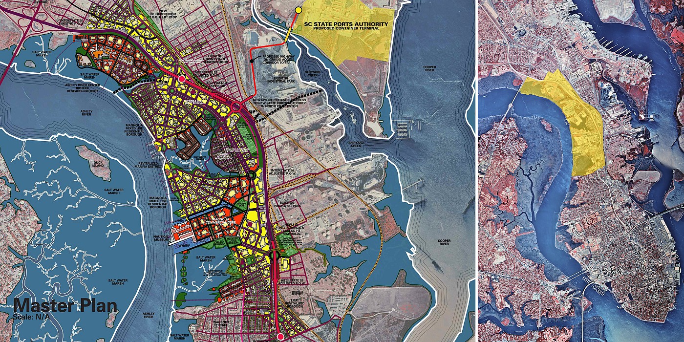
Between the cities of Charleston and North Charleston, South Carolina, lies an approximately 3,000 acre, ignored and abandoned industrial sector. Known as "The Neck," the area is split down the middle by Interstate 26 by underutilized rail lines and marginalized city streets. The land use consists of petroleum depots and other similar facilities along the Cooper River, with the Ashley River side being home to a collection of brownfield properties polluted with a host of contaminants. Sprinkled among this industrial wasteland are small remnants of dilapidated neighborhoods. The communities have survived despite the ignobility (and the environmental assault) of their neighbors, and the debilitating effect of having I-26 bisect them. Despite recent history, this area offers great promise for redevelopment. Located along the storied Ashley River (including saltwater marshes in various states of environmental stress), it harbors elements of Charleston's past in the form of unkept Civil War-era cemeteries, along with traces of the city's defensive wall that was erected during the Civil War. Hope, however, has been present in the form of the Greater Charleston Empowerment Corporation, which for years had advocated change.
Recognizing the intrinsic value of the area, a large environmental REIT, along with its local partner, is continually purchasing significant brownfield properties along the Ashley River. These purchases were based upon the following beliefs: 1. While "The Neck" – in both name and perception – separates the cities of Charleston and North Charleston, a new initiative—dubbed the "Upper Peninsula"—could encompass land under both cities' jurisdiction to bring the cities together; 2. Communities could be developed to be extensions of the historic city of Charleston, and the adjacent neighborhoods of North Charleston; 3. The existing neighborhood would be embraced and nurtured in every way; 4. Environmental and historic resources would be elevated, remediated and restored, to form the nucleus of both the physical form and the "story" of this new place; 5. The transportation infrastructure can be both a blessing and a curse, and the current interstate, rail lines and city street paradigm exist as a major stumbling block to realizing the area's potential; 6. Once the current infrastructure is sorted out, the development plan could catalyze a rail-based transit initiative long envisioned for the entire Charleston Peninsula; 7. Public process and engagement.